Customize Consent Preferences

We use cookies to help you navigate efficiently and perform certain functions. You will find detailed information about all cookies under each consent category below.

The cookies that are categorized as "Necessary" are stored on your browser as they are essential for enabling the basic functionalities of the site. ... 

Always Active

Necessary cookies are required to enable the basic features of this site, such as providing secure log-in or adjusting your consent preferences. These cookies do not store any personally identifiable data.

No cookies to display.

Functional cookies help perform certain functionalities like sharing the content of the website on social media platforms, collecting feedback, and other third-party features.

No cookies to display.

Analytical cookies are used to understand how visitors interact with the website. These cookies help provide information on metrics such as the number of visitors, bounce rate, traffic source, etc.

No cookies to display.

Performance cookies are used to understand and analyze the key performance indexes of the website which helps in delivering a better user experience for the visitors.

No cookies to display.

Advertisement cookies are used to provide visitors with customized advertisements based on the pages you visited previously and to analyze the effectiveness of the ad campaigns.

No cookies to display.

About Us

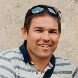
Tamás Hermann

Tamás Hermann graduated as an agronomist at the University of Pannonia Georgikon Faculty in 2002 and later defended his Ph.D. doctoral thesis in the field of soil quality assessment. Parallel with his Ph.D. studies he participated first in soil science and later in a geoinformatics postgraduate course. Between 2006 – 2012 he was involved in various land evaluation research projects as a research assistant at the University of Pannonia Georgikon Faculty, then between 2012 – 2015 he worked at the European Commission’s Joint Research Center (EC DG-JRC) in Italy on the topic of the assessment of Member States’ methodology for the identification of areas with significant natural constraints and he worked on the development and analysis of environmental databases. Between 2015 – 2020, he played a leading role in several domestic and international H2020 projects on topics of land qualification and precision management first as an assistant professor and then as an associate professor. In addition to software development, he also had a key role in providing social feedback on projects.